Following on from our iArchaeology post from August, we thought we would take the opportunity to share some our experiences making use of the iPad as a 21st century archaeology tool.
Over the last few months the VC&A iPad has been put through its paces on a 50 day field project. As part of this project we decided to use only the iPad for the excavation recording; paper was used only to write artefact tags! This is the first major project which the iPad has had continual use and for the most part it has been a great success.
This is what we have found so far…

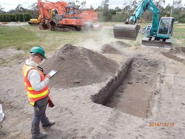
Rach recording on the iPad at Lyndhurst
Handy apps and features
The most useful app on the iPad to date has to be one of the most simple: Numbers. While this is just a basic spreadsheet app that runs on all Apple products, the use of this app to record excavation has reduced the double-handling of recorded information to nothing more than downloading the information in excel format to a computer. At this point we have managed to reduce paper wastage to nil by recording all field information on the iPad while the use of iCloud, and the cloud storage app Dropbox, makes this information constantly available to team members in our office in real time as recording happens.
The Avenza PDF Maps app is another standout recording tool which enables maps to be downloaded for offline use on the tablet. In addition to using the iPad’s built-in GPS to track the user’s location on the map, the cultural heritage advisor is able to measure distance and area and to plot photos/videos and record information about locations. Of course, this can not replace a Differential GPS (we love our Trimbles), but this handy feature worked really well with the iPad’s camera and video recorder and place marks were imported and exported easily. Transferring the information recorded in Avenza into table form cut out a lot of double-handling of data and was accomplished with the click of a button.
Other handy apps and features included: Google Maps; iDraw (great for hand-labelling photos and satellite imagery); the FieldNotes app; and the digital compass. Other apps, such as the online Munsell Colour Charts, worked better in theory than they did in practice.

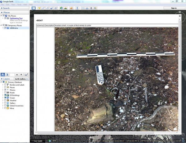
iPad data in use – revisiting field photos using google earth
The verdict.…
Overall, the iPad trial shows some promising results and has definitely increased the efficiency of data recording and processing. The iPad has also proven to have a long battery life and is hard wearing, dustproof (in its hard case), and durable.
After trialling the iPad in the field for 50 straight days we have learnt a couple of important lessons. The first, no matter how much protective covering we place on the iPad to protect it from wind, rain and dust, it is not so easy to protect it from heat. On days of harsh heat we found that automatic iCloud uploads became less reliable and a little slow. This was easily worked around by implementing a schedule of manually backing up each time recording was paused.
The second lesson is that an anti-glare screen protector is an essential accessory to combat the constant glare of the sun, which otherwise makes it difficult to see the iPad screen through the middle of the day.
However, the most important lesson we have learnt is a basic ‘Technology 101’ fundamental: always back up the day’s work! Technology is amazing, and the use of the iPad has saved so much time and effort that it is easy to become complacent. Backing up to two cloud storage programs, iCloud and Dropbox, provides peace of mind in case anything goes wrong over-night.
The use of the iPad in the field raises lots of exciting possibilities for iArchaeology. Future app-lications under consideration include creating stratigraphic profiles and top plans in iDraw, and generating Harris Matrices for contextually complex historic sites using OmniGraffle. Long term goals include creating a master database for data collected from all our projects, not only for archival purposes but also to improve data cross-referencing.
